Mapping Thurberville
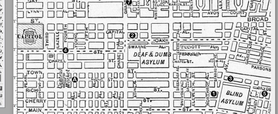
Work on the Thurber book is proceeding apace. Most of the footnotes are done, and I’m working on a map of Columbus, Ohio, when Thurber lived there. One biographer mentioned that his family moved no less than 14 times during his childhood, yet apart from a few years spent in Washington, D.C., they stayed within roughly a square mile.
This seemed incredible, so I decided to list them, which led to the idea of putting in a map of the city locating the houses.
And that’s when I fell down the rabbit hole. I spent the better part of two days rooting through vintage maps, collating the information from the various biographies (including the excellent “Thurberville,” published a few years ago by Ohio University Press).
The better part of one day was spent cleaning up a map from 1911. It was heavily colored with lines indicating electrical lines, the location of power stations, and other utilities.
It looked OK, only after studying it for awhile, I remembered that a better map was already at hand. One that didn’t need all that repair work. That’s the one at the top of the post. The numbers follow the family’s move from house to house (one of them is beyond the scope of this map and will be covered in a separate map), while the lettered locations are for other important locations in Thurber’s life (not all of them are on there).
This is one of the more frustrating yet rewarding parts of doing history. Explaining something well takes time. Designing a map takes time, and it takes several passes to do it right.
In the end, the result will be something that repays study, and in this case will show the reader how small Thurber’s world was. Columbus, Ohio, had about 100,000 people living there, but it still felt like a small town, and that played an important role in Thurber’s development as a writer, and a source of much of his work.


